Geography
Topography
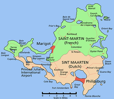
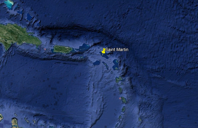
The nearest neighboring islands are Anguilla and Saint-Barthélemy, which emerge from the same submarine plateau located forty meters deep on average. A distance of 7 kilometers separates Bell Point, a cape from the north coast, from the southern coast of Anguilla. Saint-Barthélemy is located 20 km east-south-east of Point Blanche, the southern end of Île Saint-Martin.
On the other hand, Saba, Saint-Eustache, Saint-Christophe and Niévès are more distant although generally visible.
The coast of Saint-Martin is divided into numerous bays bordered by around thirty white sand beaches, but some bays are bordered only by pebbles.
There are many brackish water ponds (classified by size): Grand Étang de Simsonbaai, Great bay, Fish pond, Étang de Grand-Case, Étang Chevrise, Étang Guichard, Grand Étang des Terres Basses, (etc) which formed at the bottom of bays by strings of coastal sand.
The rest of the coast is often steep with cliffs reaching forty meters high.
There are a dozen islets around the island, the largest of which is the very tourist Pinel islet with its three beaches. We must add Tintamarre Island located three kilometers from the coast.
With the exception of several coastal alluvial plains and valley bottoms, the relief is mountainous with a steep slope, consisting of numerous hills arranged in a north-north-east, south-south-west fold. The ridge lines have an average altitude of around 300 meters intersected by several passes. The highest peak is the Paradis peak, culminating at 424 meters, in the French zone (a cemented road goes up there). These reliefs are crossed by approximately forty kilometers of more or less marked paths which penetrate the dry forest and the savannas.
A main road goes around the island by the coast to avoid these hills.
There are a few small sources of runoff, more or less captured (the most productive being “Moho” in the ravine between the district of Orleans and Pic Paradis), but their insufficient flow causes rapid infiltration of water. The island therefore does not have permanent rivers but generally dry ravines which can become torrential and dangerous during heavy rains and cyclones. The water tables of the plains are more or less brackish.
The communication routes are maritime (commercial port of Philipsburg) and air with the Princess Juliana international airport in the Dutch part and the Grand-Case Espérance airport in the French part.
Saint Martin is the smallest inhabited island in the world to be crossed by an international border
Environment
On the east coast, uninhabited islets (such as the Tintamarre and Pinel islands) are surrounded by small fringing coral formations. The sandy bottoms are colonized by vast seagrass beds. While in Saint-Barthélemy, the mangrove cords are reduced to narrow relics, in Saint-Martin, they largely border the shores of coastal lagoons (including Simpson lagoon, fish pond, etc.) and a few bays (Anse Margot , Oyster Pond, etc.).
National nature reserve of Saint-Martin.
A national nature reserve created in 1998 protects islets and a maritime part.
Geology
This arc is a result of the subduction of the Atlantic plate under the Caribbean plate.
The volcanism engendered fifty million years ago (Eocene) brought the seabed closer to the luminosity of the surface of the waters, which, from 40 meters deep, enabled 36 million years ago (during the Oligocene) the development of the coral reef, thus increasing the deposits of limestone on the submerged sedimentary platform of Anguilla called “bench of Anguille”. These are the oldest soils, with hard limestones in Pointe Blanche type strata (located at the port of the Dutch zone), Mount Billy Folly (located at Lay bay) and Tintamarre Island with its selenite crystals (gypsum) and its marine fossils, then the carbonate tabular formation of the Lowlands (peninsula linked by the sands of Simsonbaai and Nettle Bay) with its purple porphyries of red Mornes.
Subsequently, at the beginning of the Neogene, around 23 million years ago, the geological formation of the island was complicated by the intrusion of a volcanic surge through the “Banc d’Anguilla”. This is what gave the central skeleton of the currently highest hills. About 10 million years ago in the late Miocene (mid-Tertiary), the island began to emerge from the ocean.
The coastal sand cords were formed during the Holocene (ex-Quaternary) and are still evolving today.
The surface of the island and its contours varied according to the sea level (−110m / + 40m) as a result of marine transgressions due to variations in glaciations on the globe. So 12,000 years ago and several times before the island was united in a single block with the sister islands Anguilla and Saint-Barthélemy located on the same underwater bank currently at an average depth of −40 m to – 60 m. For an isobath depth of 70 meters, this block should cover an area of approximately 4,650 km2, i.e. 53 times the current island or even half of the island of Puerto Rico
The soil of the island’s hills (on the summits or on the slopes) is strewn with boulders and remains of coral reefs. Under a very thin layer of humus, the subsoil is mainly composed of volcano-sedimentary tuffs and metamorphic rocks with a grainy structure (diorite, peridotite, gabbro, andesite, etc.). In places, purple basalt dykes emerge (Mont Fortune, Fort Louis, etc.).
At Pointe Arago, we can observe a particular formation along the coast noted by the geologist Denis Westercamp: these are “pillow-lavas” (or cushion rocks) coming directly from solidified lavas under the sea.
Garnet crystals are found in the ravine of the hamlet of Saint-Louis.
Weather
The island experiences the oceanic climate of the Intertropical Convergence Zone, with a so-called “dry” season (from December to May) and a so-called “wet” season (from June to November) with possible heavy rainfall during depressions that can cause cyclones. The absolute air temperature can vary from 17 ° C to 35 ° C for an annual average of 27 ° C. The surface sea temperature is fairly constant between 25 ° C and 28 ° C.
Flora
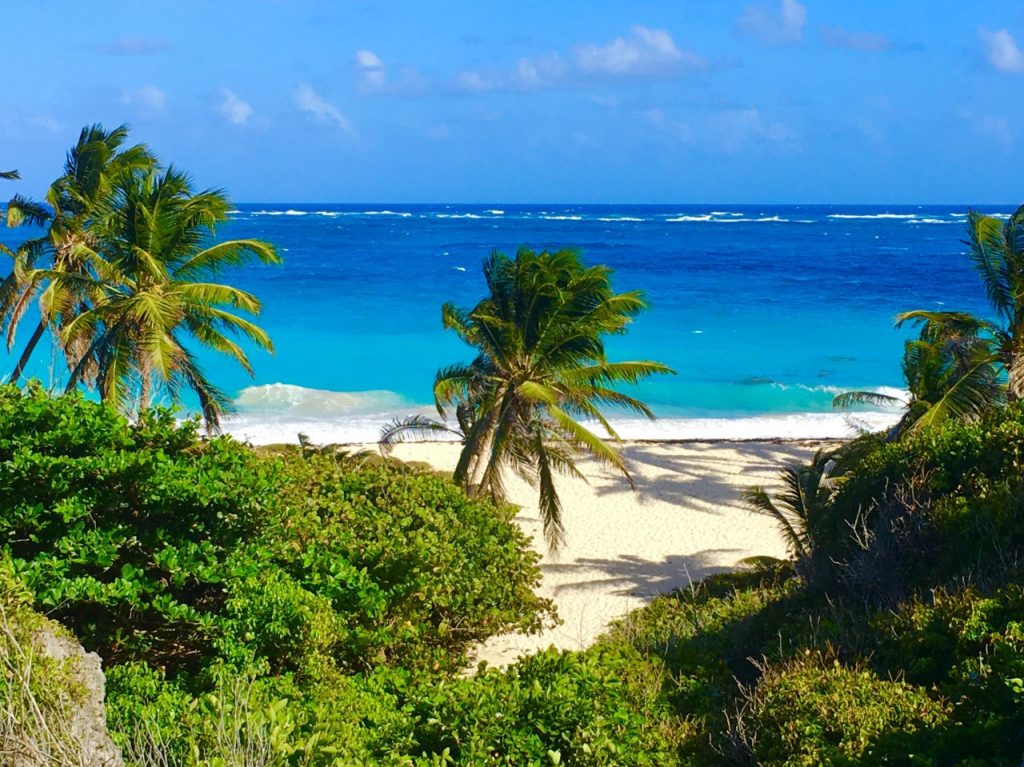
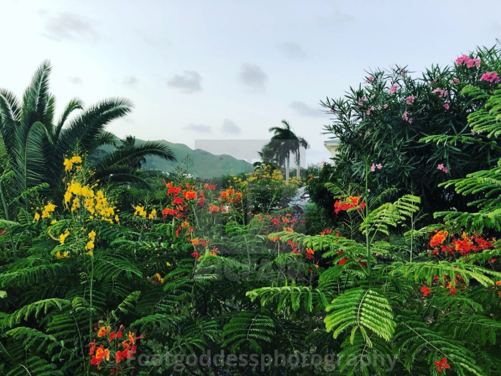
Over the course of European colonization, since 1633, the original vegetation which covered the island has been totally degraded by human activities such as successive farming, the creation of grazing land by burning and the exploitation of trees for the construction or manufacture of charcoal. Today, outside the urbanized areas, the plant cover is made up of secondary forests more or less xerophilic according to the exposure and the altitude, dry and thorny thickets of acacias and remains of savannas dominated by tall grasses of Guinea (Panicum maximum).
Forest tree species: white gum, red gum, mahogany, guaiac, etc.
Coastal tree species: the grape-maker by the sea.
Wildlife
Wild mammal fauna is limited to bats (five species), racoons, mongooses, rats and mice. We can also point out the presence of a few colonies of green monkeys, or Callitriche (invasive) notably around Pic Paradis and on the heights of Bellevue but also on the Dutch side. They appeared (probably imported) more than 20 years ago but have existed for a long time in other nearby islands like St. Kitts.
The avifauna counts more than a hundred species (marine, littoral, terrestrial).
Among the reptiles are sable turtles, lizards, geckos, iguanas, and two harmless species of microserpents. Add amphibians with two species of frogs including the tiny “coqui” and the invasive big tree frog from Cuba.
As everywhere on Earth, the group of Arthropods (including insects) is the richest in diversity. The most visible are the butterflies. For the inhabitants, the most painful insects on a daily basis are mosquitoes (4 species including the Aedes aegypti vector of dengue and since the end of 2013 of chikungunya) and cockroaches; There are also wasps and spiders (scolopendres and amblypyges).
